Official website links end with .gov.sg
A Singapore Government Agency Website


Secure websites use HTTPS


The following maps are required for Development Control Submissions.

(1) Jurong
(2) Kranji
(3) Pandan
(4) Woodlands
(5) Kallang
(6) Bukit Timah
(7A) Singapore River
(7B) Stamford Marina
(8) Geylang
(9) Punggol
(10) Changi
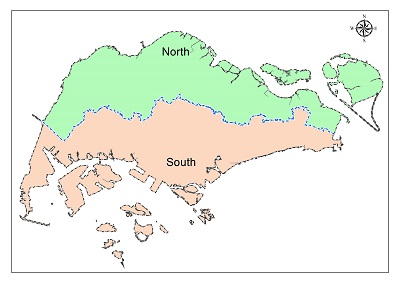
Download the Drainage Catchment Map in pdf file format.
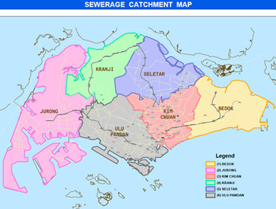
(1) Bedok
(2) Jurong
(3) Kim Chuan
(4) Kranji
(5) Seletar
(6) Ulu Pandan
Download the Sewerage Catchment Map in pdf file format.
(1) Jurong
(2) Kranji
(3) Pandan
(4) Woodlands
(5) Kallang
(6) Bukit Timah
(7A) Singapore River
(7B) Stamford Marina
(8) Geylang
(9) Punggol
(10) Changi
Download the Drainage Catchment Map in pdf file format.
(1) Bedok
(2) Jurong
(3) Kim Chuan
(4) Kranji
(5) Seletar
(6) Ulu Pandan
Download the Sewerage Catchment Map in pdf file format.