Official website links end with .gov.sg
A Singapore Government Agency Website


Secure websites use HTTPS


|
Date of Event |
Start date: 7 September 2026 End date: 24 October 2026 Refer to schedule below |
|
Time |
Refer to schedule below |
|
Location |
Marina Reservoir (Kallang Basin) |
|
Crafts |
RC413, SR3154B, SR3861Z (Work Boat) and SR3589J |
|
Contact Person |
Silvere @ 9878 9164 (MTC) |
Table 1: Details of Works at Kallang Basin
|
Date |
Time |
Activities |
Safety Remarks |
|
07/09/2026 to 14/09/2026 |
0700hrs to 1900hrs |
Craning Ops at Kallang Basin
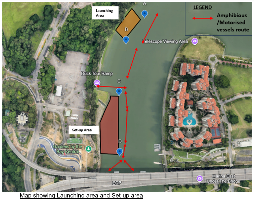
Configuration of cubi system/ pontoons at launching area.
Installation of sinkers.
|
All vessels are to keep clear of setup areas. (Refer to Map) |
|
15/09/2026 to 21/09/2026 |
0700hrs to 1900hrs |
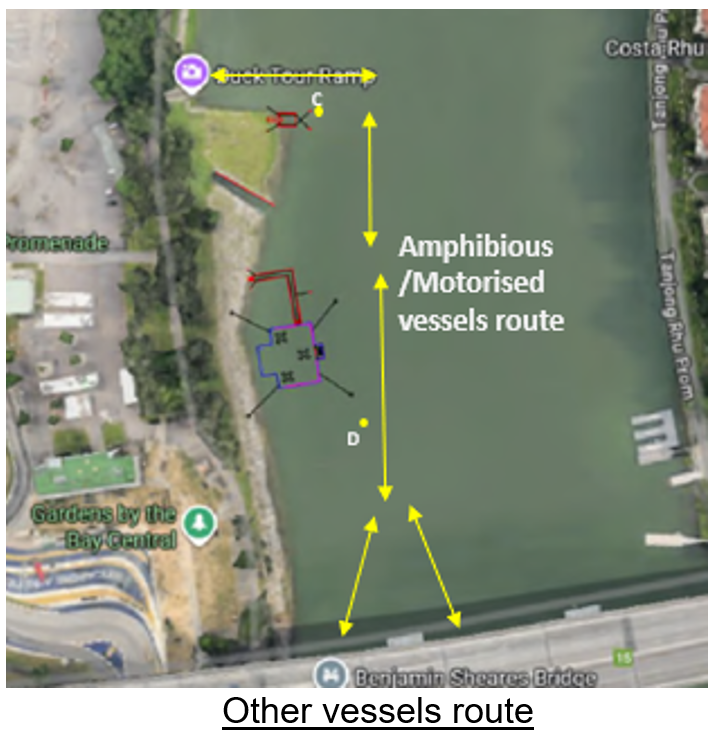
Towing of pontoons/ Cubi system from launching area to set-up area (demarcated by Buoys C and D) for positioning and anchoring.
Buoys with flashing yellow lights will be installed.
|
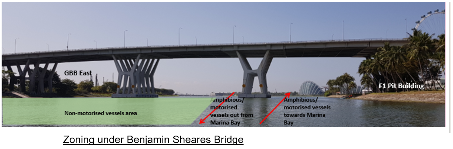
All vessels are to keep a wide berth to the towing operations and keep clear of set up areas. (Refer to Map)
|
|
22/09/2026 to 08/10/2026 |
0700hrs to 2300hrs |
Setting up of gangways and pontoons at set-up area.
|
All vessels are to keep clear of setup areas. (Refer to Map)
|
|
12/10/2026 to 28/10/2026 |
0700 – 1900hrs |
Removal of buoys and de-installation of pontoons.
Towing of pontoons/ Cubi system from set-up area back to launching area for dismantling.
|
All vessels are to keep a wide berth to the towing operations and keep clear of tear-down areas. (Refer to Map) |
|
Point |
Latitude |
Longitude |
Buoyant Color |
Light Characteristics |
|
Marker Buoy A |
1o17'55.52" N |
103o51'54.44" E |
Yellow |
Yellow Light with Flash. 0.5 sec on, 1 sec off |
|
Marker Buoy B |
1o17'52.55" N |
103o51'52.91" E |
Yellow |
Yellow Light with Flash. 0.5 sec on, 1 sec off |
Launching area
|
Point |
Latitude |
Longitude |
Buoyant Color |
Light Characteristics |
|
Marker Buoy C |
1o17'47.11" N |
103o51'52.96" E |
Yellow |
Yellow Light with Flash. 0.5 sec on, 1 sec off |
|
Marker Buoy D |
1o17'40.95" N |
103o51'53.91" E |
Yellow |
Yellow Light with Flash. 0.5 sec on, 1 sec off |
Set-up area
