Official website links end with .gov.sg
A Singapore Government Agency Website


Secure websites use HTTPS


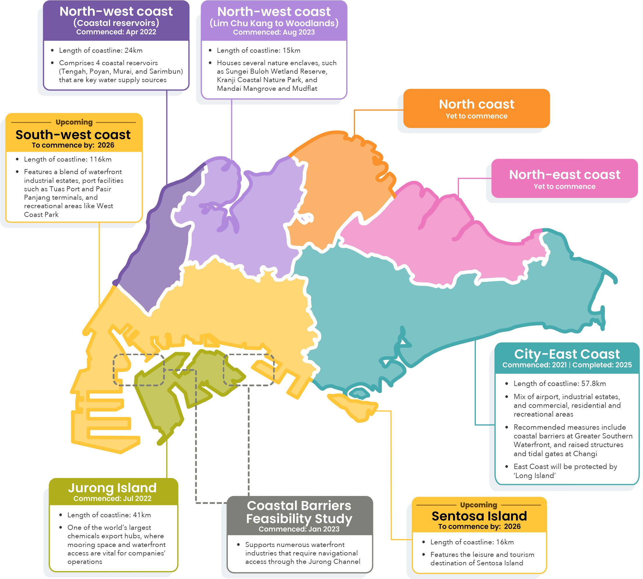
Every stretch of our coastline is unique. We conduct site-specific studies so that we can tailor protection plans for each area.
Our studies follow a comprehensive process that begins with understanding what exactly we need protection from. The Coastal-Inland Flood Model assesses inland and coastal flood risks to understand the twin impacts of intense rainfall and extreme sea levels on Singapore, incorporating the latest climate science data. Using this advanced flood modelling tool, we pinpoint vulnerable spots, as well as identify how floodwaters flow and where they gather.
With this information, we then create tailor-made solutions by working closely with our stakeholders to examine different protection measures and assess which could fit seamlessly with existing uses and future plans for the area, maximising each measure's value while providing a strong shield against rising sea level threats.
We embarked on this journey in 2021, starting with the City-East Coast stretch, followed by the Northwest Coast and Jurong Island. By 2026, Site-Specific Studies including the Southwest Coast and Sentosa will cover over 80% of Singapore's coastline.
Assess existing site conditions and conduct technical analyses
Identify a range of potential solutions
Incorporate community feedback when narrowing down the solutions
Recommend solutions best suited to each site